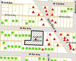
City of Eugene

City of Eugene

Eugene ArcGIS Maps

Controls
Clears the selected site marker from the map.
Resets the map to its initial state.
Legend Tax Lot Boundaries Legend Eugene City Limits Legend Eugene Urban Growth Boundary Legend
National Register The National Register of Historic Places is the official list of the Nation's historic places worthy of preservation. In Oregon, they are approved for listing by the State Historic Preservation Office. The City of Eugene regulates alterations, moving and demolition of all National Register properties in Eugene.
City Landmarks City of Eugene Historic Landmark status identifies local sites, buildings or structures that are significant to the history and development of Eugene. The City of Eugene regulates alterations, moving and demolition of all Historic Landmark properties in Eugene.
Surveyed Sites Cultural resource surveys document individual historic properties in order to increase public awareness of the built environment and to help integrate historic preservation into community planning by promoting their wise use into the future.
Points of Interest Places of historic interest in Eugene which may or may not be on the National Register or designated City Landmarks.
Areas Zoned Historic Sites containing a specific building, structure or archeological resource that qualifies as historic may be zoned S-H (Special Historic) to ensure that permitted uses encourage preservation of historic qualities.
Historic Districts Eugene has 2 designated historic districts which are on the National Register of Historic Places:
  • Blair Boulevard Historic Commercial Area
  • East Skinner Butte Historic District
Survey Boundaries The City has been conducting cultural resource surveys since 1986. Historic Survey Boundaries Legend

Enter an address or tax lot and we'll mark it on the map so you can find historic sites nearby.

How Search Results are Displyed
Historic Preservation in the City of Eugene Historic Eugene

Eugene's cultural resource surveys are the culmination of decades of field work that identifies the community's historic resources on a neighborhood basis. The City of Eugene has been conducting these surveys since 1986, and the information helps us to understand Eugene as it existed prior to 1950. The survey sheets are the raw data produced on the individual properties that have been identified as being over fifty years of age. The cultural resource surveys document individual historic properties in order to increase public awareness of the built environment and to help integrate historic preservation into community planning by promoting their wise use into the future. Ideally, these surveys will encourage the preservation of these resources with individual nominations for listing as City of Eugene Historic Landmarks or in the National Register of Historic Places.

This interactive map supplements information available on the City website's Historic Preservation pages.

Maps and GIS Disclaimer

The maps and data available for access from the City of Eugene are provided "as is" without warranty or any representation of accuracy, timeliness or completeness. The burden for determining accuracy, completeness, timeliness, merchantability and fitness for or the appropriateness for use rests solely on the user accessing this information. The City of Eugene makes no warranties, expressed or implied, as to the use of the maps and data available for access at this website. There are no implied warranties of merchantability or fitness for a particular purpose. The user acknowledges and accepts all inherent limitations of the maps and data, including the fact that the maps and data are dynamic and in a constant state of maintenance, correction and revision. Any maps and associated data for access do not represent a survey. No liability is assumed for the accuracy of the data delineated on any map, either expressed or implied.

Map Tips
To Pan the Map:
  • Left-click and drag with the mouse
  • Double-click the left mouse button.
  • Use the Arrow keys (← ↑ ↓ →)
To Zoom In or Out:
  • Use the zoom slider in the upper left hand corner of the map:
    Zoom slider
To Zoom In:
  • Scroll the mouse wheel forward
  • Use the + key
  • Press the Shift key, then Left-click and Drag the mouse:
    Zoom in by dragging the mouse
To Zoom Out:
  • Scroll the mouse wheel backward
  • Use the - key
  • Press the Shift and Ctrl keys, then Left-click and Drag the mouse.
To See Site Details:
  • Click the symbol on map for the property:
    See site details
Error Icon
Information Icon
Question Icon
Warning Icon